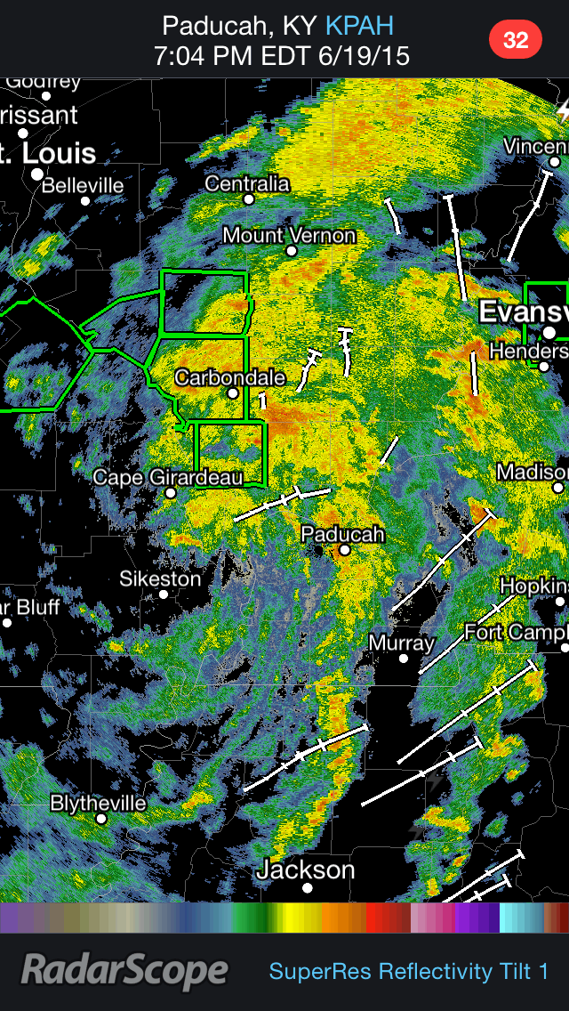
Tropical Storm Bill made landfall along Texas' Gulf Coast on Tuesday, June 16th, with winds to 60 mph and heavy rain. Now, less than a week later, our area will be affected by the rainy remnants of that tropical cyclone. Bill has certainly left its mark on the areas that it has passed through, bringing several inches of rain to portions of Texas and Oklahoma and severe weather (including tornadoes) to the Midwest. Below is a radar loop of what Tropical Depression Bill looked like this evening over the Missouri/Illinois/Kentucky border area.
 |
| Tropical Depression Bill Radar Loop (Gif courtesy of RadarScope) |
So how will these tropical remnants affect our Father's Day Weekend in southern New Jersey? Well, an unstable atmosphere will allow for scattered showers and thunderstorms to spark up across the region on Saturday during the daytime hours. However, this is not the main concern. Bill's area of low pressure will approach and push through Philadelphia and South Jersey late Saturday night and into Sunday morning. The heaviest of the rainfall and storms look like they will fall after midnight and last into Sunday morning (likely out by 9am-12pm). The image below shows this afternoon's NAM model run of the simulated radar at 8am on Sunday morning, showing heavy precipitation over the area.
 |
| 18Z NAM model run's for Sunday morning at 8am (Image courtesy of Tropical Tidbits) |
The whole region is under a Flood Watch due to the potential for a long duration of heavy rainfall over a short amount of time. Generally-speaking, it looks like we will be looking at upward of 1-3" of rain through overnight hours of Saturday/Sunday and Sunday morning. Though, isolated locations could see 3"+ of rainfall, as the low pressure center brings a ball of very heavy precipitation into Southeast Pennsylvania and New Jersey. The image below shows a swath of heavy rainfall totals through Sunday evening from Kentucky to South Jersey.
 |
| Modeled precipitation totals through 8pm on Sunday evening (Image courtesy of the WPC) |
Finally, it does appear that when the rainfall ends Sunday morning, dry air will quickly pull in behind it to begin to dry things out. Sunshine will likely make a return for the afternoon and evening (partly cloudy skies), but there will be the threat for scattered PM showers and storms as a low moves off to the north and a front moves through the area.


No comments:
Post a Comment